Geography
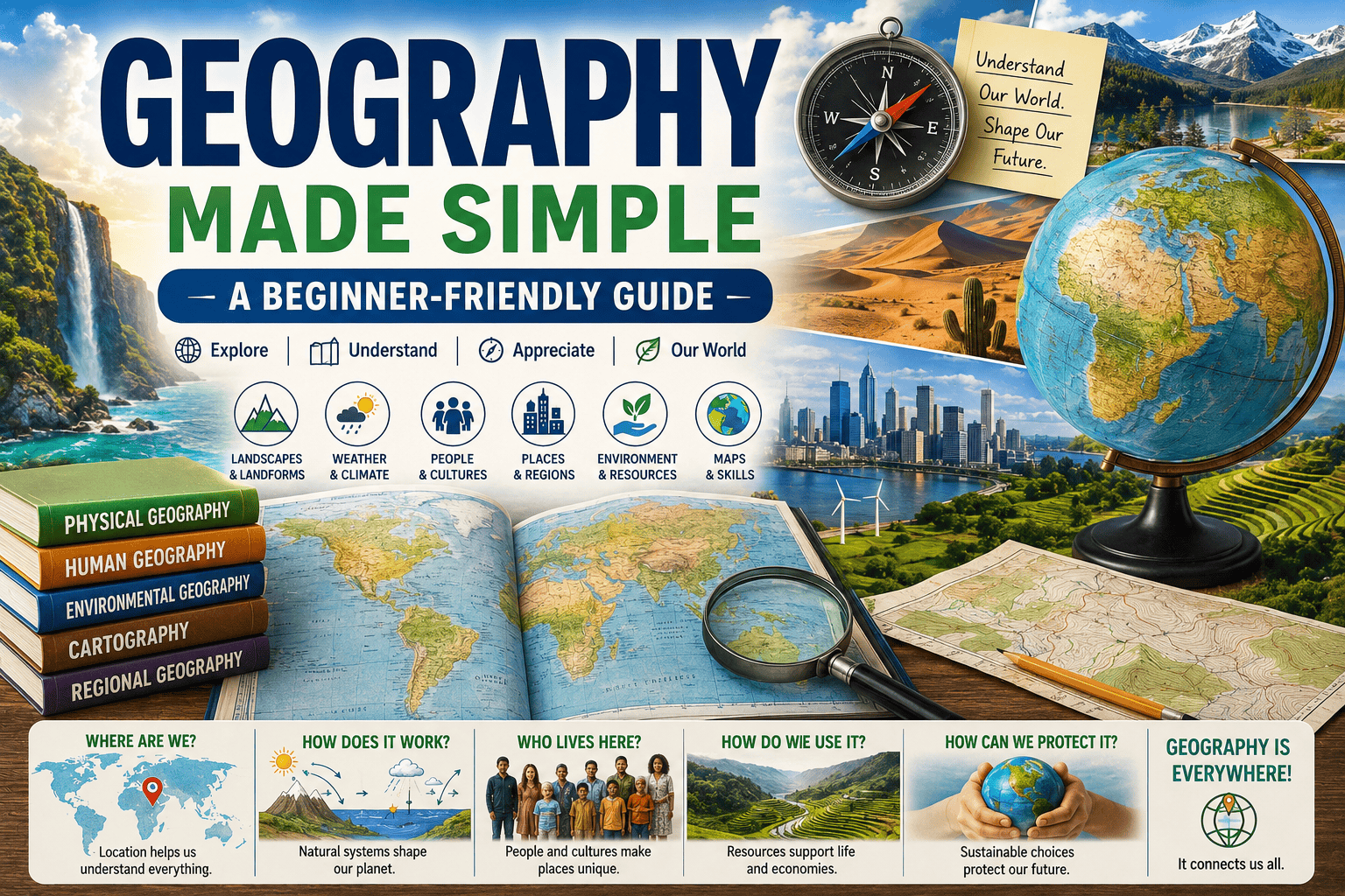
Geography is the study of Earth’s landscapes, environments, and the spatial relationships between people, places, and natural phenomena. It encompasses two major branches: physical geography, which examines natural features like climate, terrain, and ecosystems, and human geography, which explores how societies, cultures, and economies interact with and shape their surroundings. Through maps, spatial analysis, and fieldwork, geography reveals patterns in how location influences everything from weather to migration to urban development. At its core, it asks how place and space shape the world we live in.
Content Overview
- Introduction to Geography
- Chapter 1: Physical Geography
- Chapter 2: Human Geography
- Chapter 3: Geographical Information Systems (GIS)
- Chapter 4: Cartography and Map Reading
- Chapter 5: Economic Geography
- Chapter 6: Political Geography
- Chapter 7: Environmental Geography
- Chapter 8: Cultural Geography
- Chapter 9: Transportation and Urban Geography
- Chapter 10: Regional Geography
- Chapter 11: Geography of Hazards and Disasters
- Chapter 12: The Future of Geography
- Conclusion
Introduction to Geography
Introduction to Geography
Geography is the study of Earth’s landforms, environments, and how people interact with them. It includes both natural features and human activities, helping us understand patterns and changes across different places. Learning geography is important for dealing with global issues like climate change, growing cities, and managing resources.
Definition of Geography
Geography is the science that studies the Earth, its natural features, human populations, and how people interact with their surroundings. It helps us understand the location of things, the reasons behind their placement, and how different places are linked.
In simple terms, geography helps us understand:
- The natural world (mountains, climate, oceans)
- Human activities (cities, culture, economy)
- Human–environment interaction
Importance of Geography
Geography is important because it helps us:
- Understand climate change and natural hazards
- Plan cities and transportation systems
- Manage natural resources
- Understand cultural diversity and globalization
Example:
Knowing geography helps governments get ready for natural disasters like floods, earthquakes, and droughts.
Geographical Perspectives and Approaches
Geographers study the world using different approaches:
- The spatial approach focuses on understanding why things are located in certain places.
- Human–environment approach: How humans affect nature
- Regional approach: Studying specific regions of the world
Example:
It involves examining why deserts are found near the Tropics of Cancer and Capricorn.
Chapter 1: Physical Geography
Physical geography looks at the Earth’s natural features and the processes that shape them.It explains the Earth’s layers—such as the crust, mantle, and core—and describes their features.
It describes the difference between climate and weather and the factors that affect climate in different regions.
– Landforms and Topography: Describes various landforms, including mountains, valleys, plateaus, and plains.
Example: Mountain ranges like the Himalayas are formed by the movement of tectonic plates, along with processes such as erosion and uplift.
The Earth’s Structure and Composition
The Earth has three main layers:
- Crust: Earth’s outer layer
- Mantle: Semi-molten layer beneath the crust
- Core: Extremely hot and dense center
Example:
Volcanoes occur due to movements in the mantle.
Climate and Weather Patterns
- Weather: Short-term atmospheric conditions
- Climate: Long-term weather patterns of a region
Factors affecting climate:
- Latitude
- Altitude
- Ocean currents
Example:
Coastal areas have milder climates due to ocean influence.
Landforms and Topography
Landforms are the natural shapes found on the Earth’s surface, such as:
- Mountains
- Valleys
- Plateaus
- Plains
Topography describes the form and height of the land surface.
Formation of Mountain Ranges
Mountains form due to:
- Plate tectonics
- Volcanic activity
- Folding and faulting
Example:
The Himalayas formed as a result of the collision between the Indian and Eurasian tectonic plates.
Chapter 2: Human Geography
Human geography focuses on human populations and activities.
Population distribution and density study how and why people are spread across the world, including differences between urban and rural areas.
– Cultural Landscapes and Identity: Discusses how culture shapes landscapes and influences identity.
Urbanization and megacities examine the fast growth of cities and their effects on society, the economy, and the environment.
Example: The development of New York City into a major global city, known for its cultural diversity and economic importance.
Population Distribution and Density
Population distribution shows where people live, while density shows how many people live per unit area.
Factors influencing population:
- Climate
- Resources
- Employment opportunities
Example:
High population density in river valleys.
Cultural Landscapes and Identity
Cultural landscapes are shaped by human activity, including:
- Architecture
- Agriculture
- Religion
Example:
Mosques, temples, and churches shape cultural identity.
Urbanization and Megacities
Urbanization is the process where people move from the countryside to cities.Megacities have populations over 10 million.
Example:
Tokyo and Delhi are megacities.
Growth of New York City
New York grew due to:
- Trade and ports
- Industrialization
- Immigration
Chapter 3: Geographical Information Systems (GIS)
Introduction to GIS technology explains what GIS is and describes its main parts, such as hardware, software, and data.
Applications of GIS in different fields explain how it is used in urban planning, managing the environment, and responding to disasters.
Mapping and spatial analysis describe how studying locations and patterns helps us understand geographic relationships.
Example: Using GIS in environmental management, like tracking deforestation and planning ways to protect forests.
Introduction to GIS Technology
GIS is a computer-based system used to:
- Store geographical data
- Analyze spatial patterns
- Create maps
Applications of GIS
GIS is used in:
- Urban planning
- Disaster management
- Agriculture
- Environmental studies
Mapping and Spatial Analysis
Spatial analysis helps identify patterns and relationships between places.
GIS in Environmental Management
Example:
GIS helps track deforestation and pollution levels.
Chapter 4: Cartography and Map Reading
History of cartography explains how map-making has developed from ancient times to the modern digital era.
Types of maps and their uses describe various maps—such as topographic, thematic, and political—and what they are used for.
Understanding map scales and projections explains how scale shows distance and how map projections affect how places are represented.
Example: The Mercator and Peters projections show how maps can distort size and shape in different ways.
History of Cartography
Cartography is the science of map-making. Early maps were based on exploration and observation.
Types of Maps
- Physical maps
- Political maps
- Thematic maps
Map Scales and Projections
Map scale explains how distance on a map compares to actual distance on the ground.Map projections show how the Earth’s curved surface is displayed on flat maps.
Mercator vs. Peters Projection
- Mercator: Distorts size, preserves direction
- Peters: Preserves area, distorts shape
Example:
Africa appears smaller on Mercator maps than it really is.
Chapter 5: Economic Geography
– Economic Activities and Industries: Explores various sectors of the economy, including primary, secondary, and tertiary industries.
Trade and globalization explain how global connections influence trade patterns and how economies depend on one another.
Resource distribution and management study how natural resources are spread across different regions and how they are used and managed.
Example: Oil reserves affect global politics, as seen in OPEC’s role in influencing oil prices.
Economic Activities and Industries
Economic geography studies:
- Agriculture
- Manufacturing
- Services
Trade and Globalization
Globalization connects economies through trade and technology.
Example:
Goods produced in China are sold worldwide.
Resource Distribution and Management
Resources are unevenly distributed across Earth.
Oil Reserves and Global Politics
Countries with oil reserves have strategic importance.
Example:
Middle East geopolitics is influenced by oil.
Chapter 6: Political Geography
– State and Nation Concepts: Differentiates between states, nations, and nation-states, and their significance in political geography.
– Geopolitical Theories: Introduces theories such as heartland theory and rimland theory, and their relevance to global power dynamics.
– Borders, Territory, and Sovereignty: Discusses the importance of territorial integrity and border disputes.
– Example: The geopolitics of the Arctic region, highlighting territorial claims and resource competition due to climate change.
State and Nation Concepts
- State: Political entity with boundaries
- Nation: Cultural identity of people
Geopolitical Theories
Explain power relations between states.
Borders, Territory, and Sovereignty
Borders define state boundaries and sovereignty.
Geopolitics of the Arctic
The melting of ice is creating new shipping pathways and making previously inaccessible resources easier to reach.
Chapter 7: Environmental Geography
– Human-Environment Interaction: Explores how humans impact the environment and vice versa, focusing on sustainability.
– Environmental Issues and Challenges: Identifies key environmental challenges such as pollution, deforestation, and climate change.
– Sustainable Practices and Conservation: Discusses strategies for managing natural resources and promoting sustainability.
– Example: The impact of deforestation in the Amazon rainforest, illustrating the consequences for biodiversity and climate.
Human–Environment Interaction
Humans depend on nature but also modify it.
Environmental Issues
- Deforestation
- Pollution
- Climate change
Sustainable Practices
Sustainability ensures long-term resource use.
Deforestation in the Amazon
Causes biodiversity loss and climate imbalance.
Chapter 8: Cultural Geography
– Culture and Its Components: Defines culture and discusses its elements, including language, religion, and customs.
– Language, Religion, and Ethnicity: Examines the geographical distribution of languages, religions, and ethnic groups.
– Cultural Diffusion and Globalization: Explains how cultures spread and interact through globalization.
Example: The global expansion of English has shaped international communication while also influencing cultural identity in different societies.
Culture and Its Components
Culture includes language, religion, traditions, and beliefs.
Language, Religion, and Ethnicity
These shape cultural identity and spatial patterns.
Cultural Diffusion
Spread of culture through migration, trade, and media.
English as a Global Language
English spread through colonization and globalization.
Chapter 9: Transportation and Urban Geography
– Transportation Systems and Networks: Analyzes the role of transportation in shaping urban development and connectivity.
– Urban Planning and Development: Discusses principles of urban planning, including zoning and land use.
– Smart Cities and Sustainable Transportation: Explores innovations in urban infrastructure and sustainable transportation solutions.
– Example: The role of public transit in reducing urban traffic congestion, highlighting successful models in cities like Tokyo and Copenhagen.
Transportation Systems
Include roads, railways, airways, and waterways.
Urban Planning
Designing cities for efficiency and livability.
Smart Cities
Use technology for sustainable development.
Public Transit and Traffic Reduction
Efficient transit reduces congestion and pollution.
Chapter 10: Regional Geography
– Defining Regions: Explains formal, functional, and vernacular regions and their significance in geography.
– Regional Characteristics and Case Studies: Analyzes various regions based on physical and human characteristics.
– Comparative Geography: Discusses the importance of comparing regions to understand differences and similarities.
– Example: A comparative study of the Sahara Desert and the Arabian Desert, focusing on climate, ecology, and human activity.
Types of Regions
- Formal (climate regions)
- Functional (urban areas)
- Vernacular (perceived regions)
Regional Characteristics
Each region has unique physical and cultural features.
Comparative Geography
Comparing regions improves understanding.
Sahara vs. Arabian Desert
Both are hot deserts but differ in climate and culture.
Chapter 11: Geography of Hazards and Disasters
– Natural Hazards: Defines natural hazards such as earthquakes, floods, and hurricanes, and their geographical distribution.
– Human-Made Disasters: Discusses industrial accidents, pollution, and their environmental consequences.
– Mitigation and Preparedness Strategies: Examines strategies to mitigate the impacts of hazards and improve disaster preparedness.
– Example: The geographical impact of Hurricane Katrina, analyzing its effects on New Orleans and the lessons learned for future disaster response.
Natural Hazards
- Earthquakes
- Floods
- Hurricanes
Human-Made Disasters
- Industrial accidents
- Nuclear disasters
Mitigation and Preparedness
Preparedness reduces disaster impact.
Hurricane Katrina
Showed how geography affects disaster severity.
Chapter 12: The Future of Geography
– The Role of Technology in Geographical Research: Discusses how technology, including remote sensing and big data, is transforming geography.
– Climate Change and Its Geographical Implications: Explores the impact of climate change on geographical patterns and human activities.
– Emerging Trends in Global Geography: Identifies key trends shaping the future of geography, including urbanization and migration.
– Example: The use of remote sensing
for climate monitoring, highlighting its importance in tracking environmental changes.
Technology in Geography
- Remote sensing
- Satellites
- AI and GIS
Climate Change Implications
Changing climates reshape regions and societies.
Emerging Trends
- Smart mapping
- Climate monitoring
Remote Sensing Example
Satellites track ice melting and forest loss.
Conclusion
Geography is essential for understanding the interconnected world. It helps us solve global problems such as climate change, urbanization, and resource scarcity.
– The Relevance of Geography in Today’s World: Summarizes the importance of geographical understanding for addressing contemporary global issues.
– Interconnectedness of Global Issues: Emphasizes the need for a holistic approach to problem-solving that considers geographical factors.
– Call to Action: Encourages readers to engage with geography in their daily lives and understand their role in shaping a sustainable future.